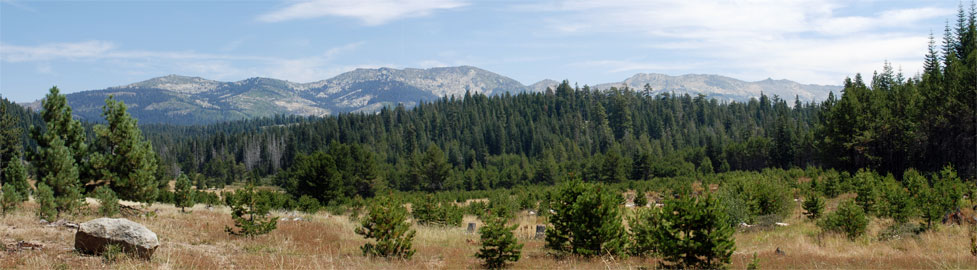
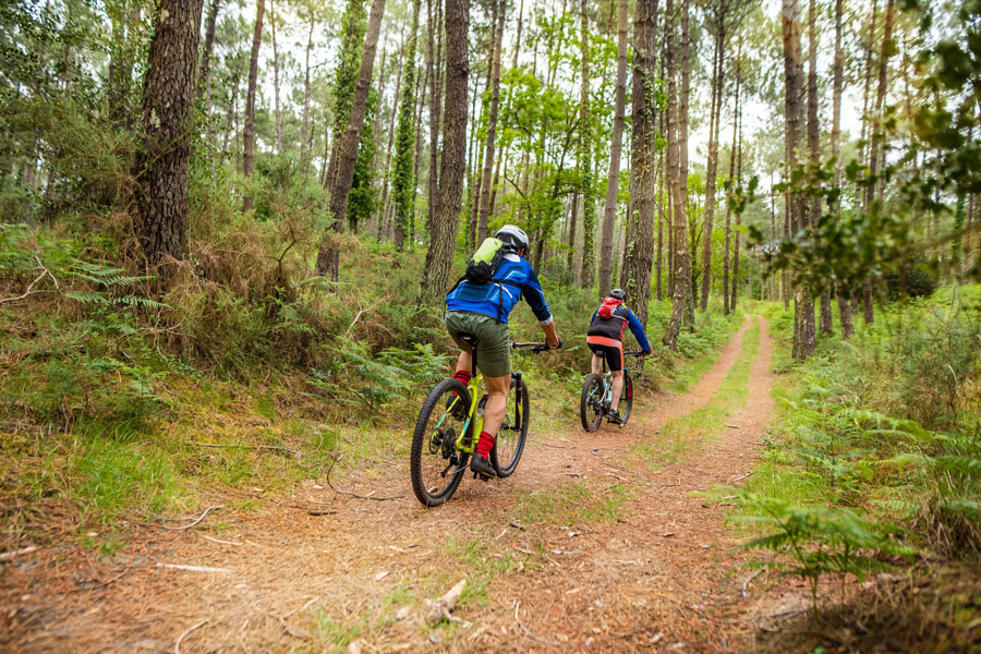
Mountain Biking around Echo Summit
With Forest Service roads criss-crossing much of Eldorado National Forest, there is never a shortage of places to explore by mountain bike. The Crystal Basin is loaded with dirt roads and single tracks. Higher on the pass explore the area around Sierra at Tahoe ski resort.
You'll find a sampling of the best routes listed here, but there are other great rides out there waiting for you to explore.
Echo Lakes
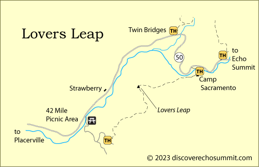
Lovers Leap
Distance: 1.6 miles one way
Elevation changes: 1,000 feet (5,900' - 6,900')
Starting Point: Strawberry Canyon Road trailhead off Packsaddle Road
This route leads to the summit of Lovers Leap, a popular rock climbing destination. Spectacular views of the American River canyon await those who reach the top. Although the trail continues beyond the top of the mountain to Camp Sacramento, mountain bikes are not allowed on that portion of the trail. On the approach riders will encounter sections of steep uphill combined with loose gravel, requiring dismounting and pushing. The return downhill trip is for advanced riders, technically very difficult.
Bryan Meadows and Round Meadows
Distance: 4 miles one way
Elevation changes: +1,600 feet (6,900' - 8,500')
Starting Point: Sayles Canyon - Bryan Meadow Trailhead off Sierra-at-Tahoe Road.
Ride one mile up Sayles Canyon Trail along the creek to the junction of Bryan Meadows trail.
Follow the trail to the east for 3 miles through forest, climbing steadily. The trail follows the ride at the top of several Sierra-at-Tahoe ski runs. At mile 3 you approach Bryan Meadow near the junction with the Pacific Crest Trail. (Remember that bikes are not allowed on the Pacific Crest Trail.)
From the same trailhead you can continue up Sayles Creek to Round Meadows, about a 3.5-mile ride.
Fleming Meadow
Distance: 8.8 miles of connecting roads and trails
Elevation: 3,700 feet
Starting Point: Off Mormon Emigrant Trail near Jenkinson Lake
The Fleming Meadow area is closed to motor vehicles and great for mountain bikers. Roads and trails wind through a thousand acres of forest and Fleming Meadow.
Map: Fleming Meadow Trail System
Bassi Falls
Distance: 2 miles one way
Elevation changes: +200 (5,000' - 5,200')
Starting Point: Millionaire Camp near Union Valley Reservoir
Make the easy 2-mile ride up to a viewpoint near the foot of Bassi Falls and then set out on adventures,
exploring the dirt roads around Wench Flat (climbing 700 feet). Eventually follow the ridge road back down
to your starting point.
Ice House Bike Trail
Distance: 3.1 miles one way
Elevation changes: Total climb +80 feet (range 5,400' - 5,480')
Starting Point: Ice House Road and Forest Road 12N06 (200 yards north of Big Hill Lookout turnoff))
The Ice House Bike Trail is a dirt trail along the shores of Ice House Reservoir. It can
be accessed from any campground around the lake.
The scenic trail follows ridges and shaded northern slopes, offering views of Ice House Reservoir and some
peaks along the Crystal Range. The bike trail ends at Strawberry Campground. Ice House Bike Trail connects with other roads in the area.
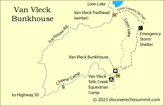
Van Vleck Trailhead to Loon Lake
Distance: 4.5 miles one way
Elevation changes: +200 (6,300' - 6,800')
Starting Point: Van Vleck Trailhead on Cheese Camp Road near the Van Vleck Bunkhouse (not the winter trailhead near Loon Lake)
The trail to Loon Lake has a fairly steady, easy grade. It offers several scenic overlooks of
the Rubicon drainage and Chipmunk Ridge. A good map of the area and a GPS would help in being sure you are
on the right trail.
Bike Shuttles and Bike Shops
Echo Summit Shuttle Service
Wanna Ride - Tahoe Bike Shuttle & Tours will deliver you and your bicycle to the top of Echo Summit from various points in South Lake Tahoe, leaving you to make the ride back down.
(775) 588-5800 Wanna Ride
Bicycle Shops
Placerville Bike Shop
1307 Broadway, Placerville
(530) 622-3015
Placerville Bike Shop
Mountain bikes, road bikes, service
Closed Sundays
Golden Spoke Bike Shop
679 Placerville Dr., Placerville
(530) 626-8370
Watta Bike Shop
2933 Highway 50 #B
South Lake Tahoe, CA
(530) 544-7700
Watta Bike Shop
Mountain Bikes - sales, tune ups, and repairs
Sierra Ski & Cycle Works
3430 Lake Tahoe Blvd.
South Lake Tahoe, CA
(530) 541-7505
Sierra Ski & Cycle Works
Mountain Bikes and Cruisers - sales, tune ups, and repairs, rentals
Anderson's Bicycle Rental
645 Emerald Bay Rd.
South Lake Tahoe
(530) 541-0500
Anderson's Bicycle Rental
Other Passes - Other Backpacking Trails
Donner Summit

At the north end of Lake Tahoe Donner Summit (Interstate 80) has miles of trails for backpacking. The Pacific Crest Trail connects with Echo Summit, passing through Granite Chief Wilderness and Desolation Wilderness. Other trails lead off from the Donner Summit area to mountain lakes and spectacular summits. For the best backpacking routes, see Around Donner Summit.
Carson Pass
Just to the south Carson Pass (Highway 88) offers more great backpacking trails. Follow the Pacific Crest Trail south to Carson Pass or take off from Carson Pass trailheads into the Mokelumne Wilderness. For the best backpacking routes, see Up and Over Carson Pass.
Ebbetts Pass
Ebbetts Pass, just south of Carson Pass, has a number of enjoyable backpacking routes. From trailheads along Highway 4 you can strike out into the Carson-Iceberg Wilderness. To learn more, visit our sister website Ebbetts Pass Adventures.
Sonora Pass
Sonora Pass (Highway 108), located farther to the south and just north of Yosemite, is famous for its backpacking in the Emigrant Wilderness and the Hoover Wilderness. For backpacking ideas on Sonora Pass, take a look at our sister website, Sonora Pass Vacations.