Weather Report
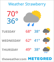
Current Conditions in Strawberry
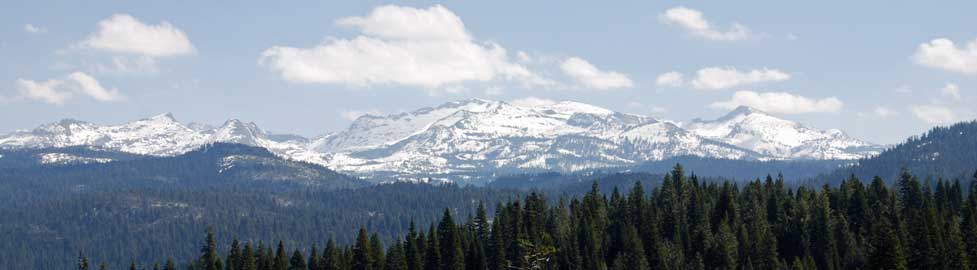
Strawberry is at an elevation of 5,750 feet and is 8 miles west of Echo Summit.
While the Crystal Basin is at a similar elevation, because it is farther west, it sometimes has quite different weather from high on the pass. A good source of weather conditions in the Crystal Basin is the Eldorado National Forest - (530) 644-6048.
For more information about the
weather higher on the pass during the winter, check Sierra at Tahoe Ski Resort's:
Sierra at Tahoe SNOW REPORT
Highway 50 Road Conditions
Highway 50 over Echo Summit is open year-round except when particularly severe weather or unusual road work closes the road temporarily. In years past landslides have cut off the highway along the American River canyon or avalanches have closed the road on the steep eastern slope, but those are rare occurrences. Usually any closures are short.
The best source for up-to-date information on Highway 50 is the CalTrans Division of Highway Operations:
CalTrans Road Information
or check
Department of Transportation - Road Conditions.
Requirement One (R1): Chains or snow tread tires required. Snow tires must have a tread depth of 6/32" with a "M & S" imprint on the tire's sidewall.
Requirement Two (R2): Chains required on all vehicles except four-wheel drives or all-wheel drives with snow tread tires on all four wheels. (NOTE: four-wheel and all-wheel drive vehicles must carry traction devices in chain control areas)
Requirement Three (R3): Chains are required on all vehicles, no exceptions.
Current Status of National Forest Campgrounds and Roads Along the Highway 50 Corridor
Many renovations are taking place in the Crystal Basin through 2022. Some may continue into 2023. Check Eldorado National Forest's Recreation Facility Renovations Schedule.
Check the Eldorado National Forest website for the most current information at campgrounds: Eldorado National Forest Campground Status.
Eldorado National Forest Roads
For information about roads in the Eldorado National Forest (including the Mormon Emigrant Trail Road), check their information at Eldorado National Forest Roads.
Snow Report Websites and Webcams
Snow Reports
Webcams
Sierra at Tahoe WEBCAMS
Heavenly at Tahoe Ski Resort WEBCAMS
DOT Webcam on Hwy. 50
(Scroll down list of camera sites for those on Highway 50 such as Pollock Pines, Twin Bridges, or Echo Lake.)